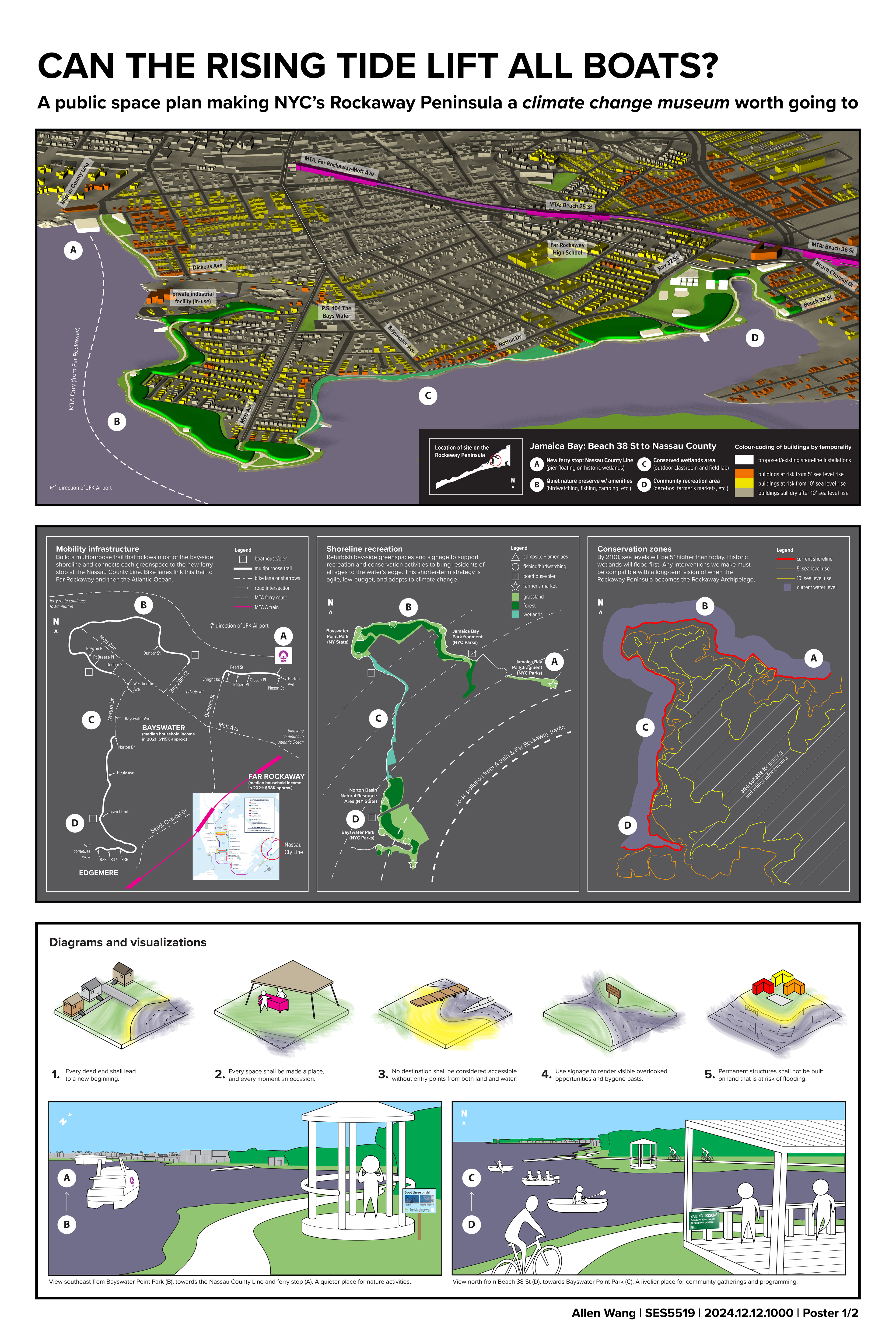
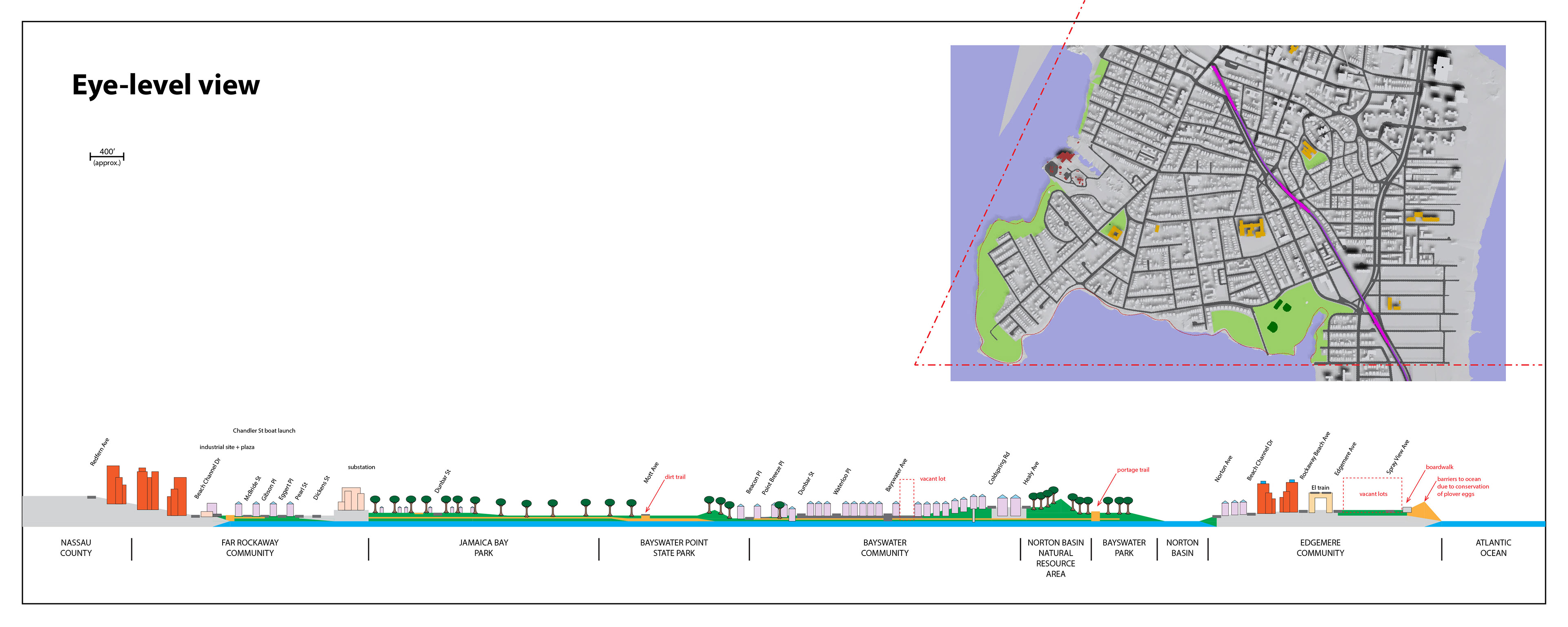
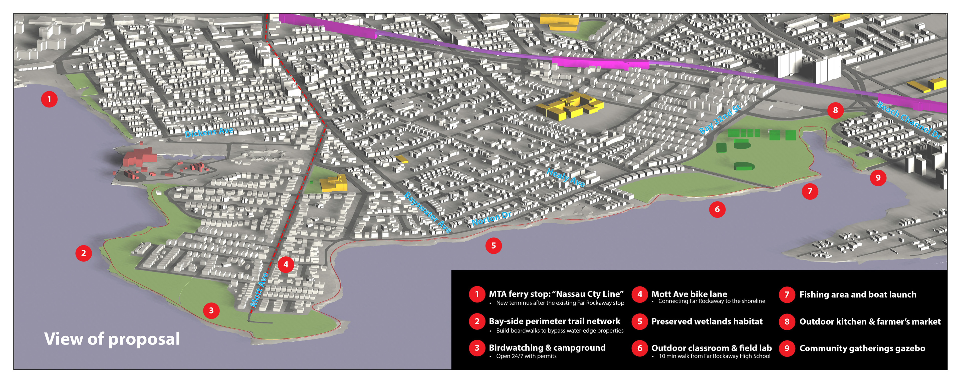
LEFT: This public space proposal defines short-term, pragmatic interventions around mobility, recreation, and conservation to make the Bay-side shoreline a destination worth going to. By connecting residents to the water's edge, the proposal affirms the inseparability of residents and ecosystems while transforming the day-to-day impacts of sea level rise into lived experiences.
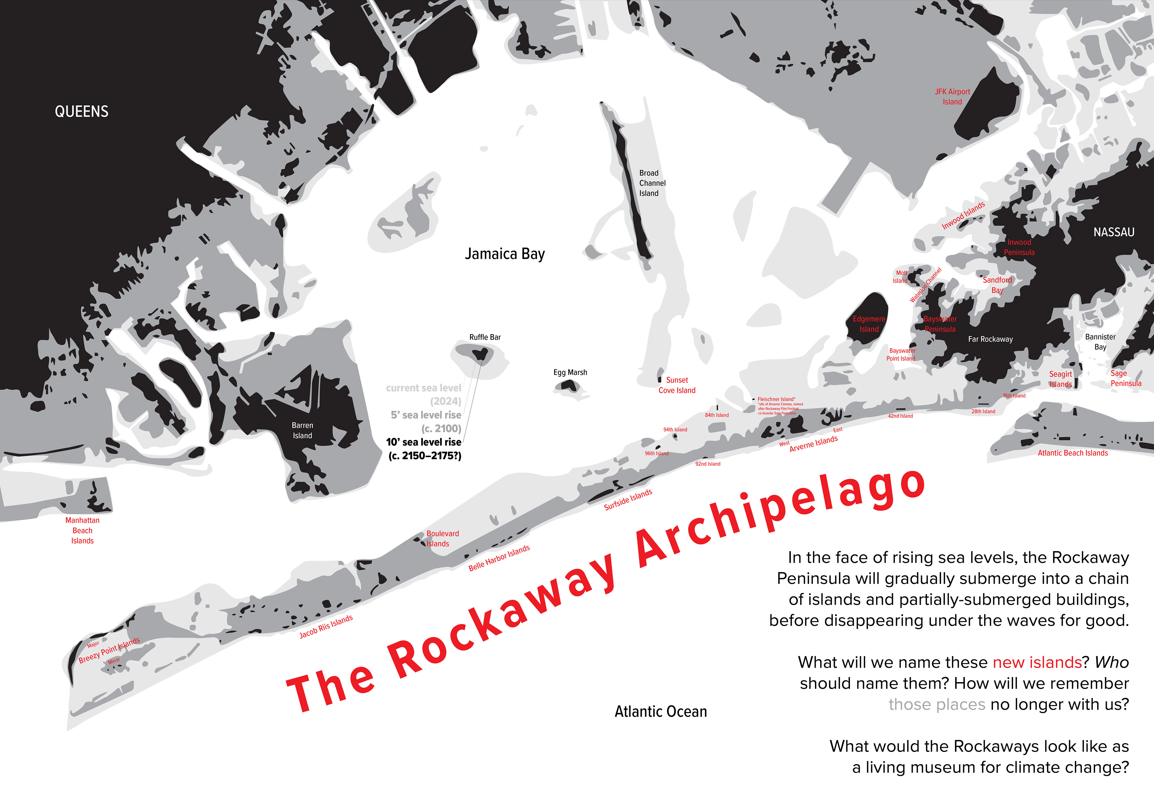
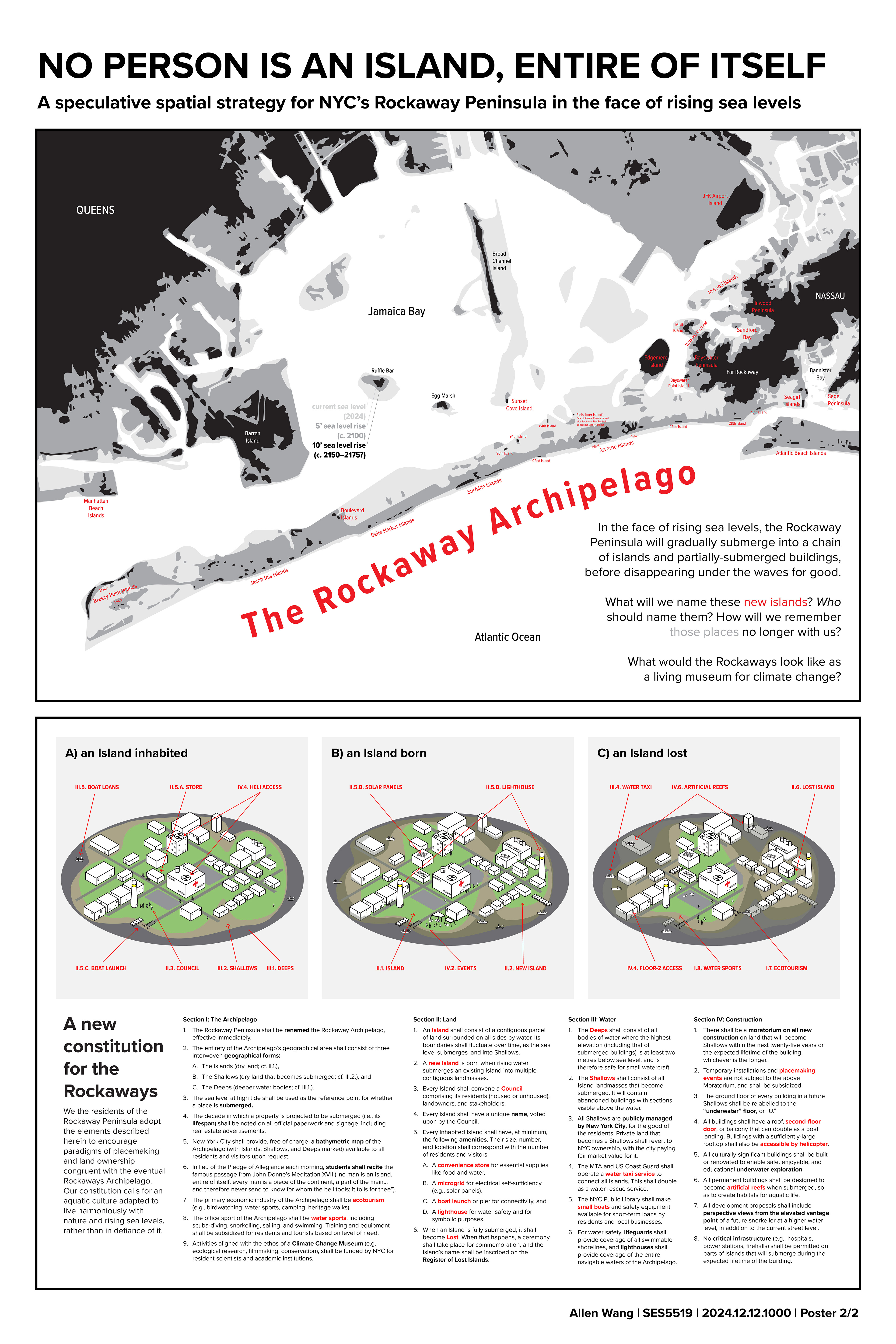
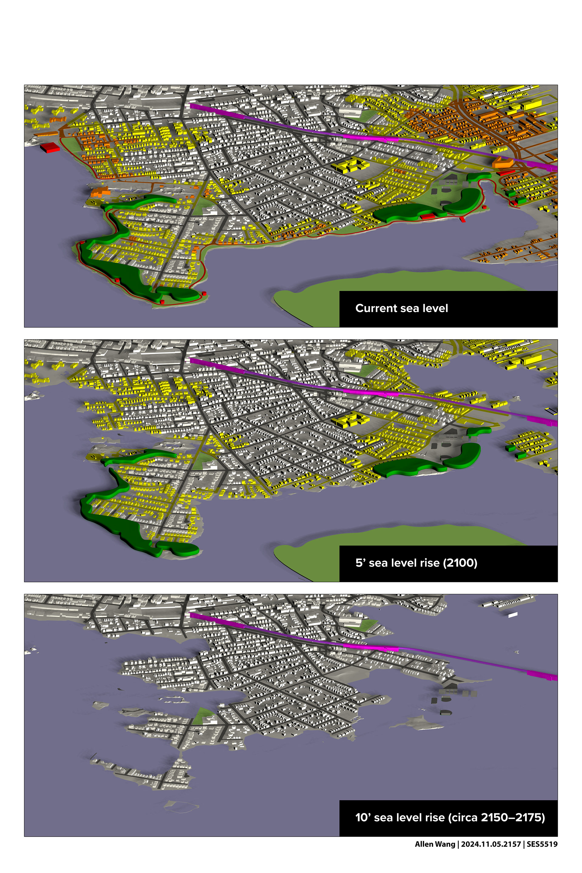
RIGHT: In the face of rising sea levels, the Rockaway Peninsula will gradually submerge into a chain of islands before disappearing under the waves for good. Targeting a 150-year time horizon, this speculative spatial strategy explores the society that will inhabit the future Archipelago: could it become a living museum for climate change?
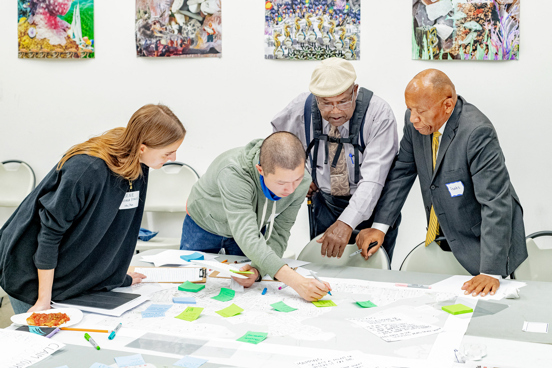
Credits: Thanks to Benedetta Zuccarelli and Piper Claudia Williams for facilitating the workshop with me; Jeanne DuPont and the RISE staff for their help organizing the workshop, connecting us with residents, and letting us use the space; and Giles Ashford for the during-workshop photo.
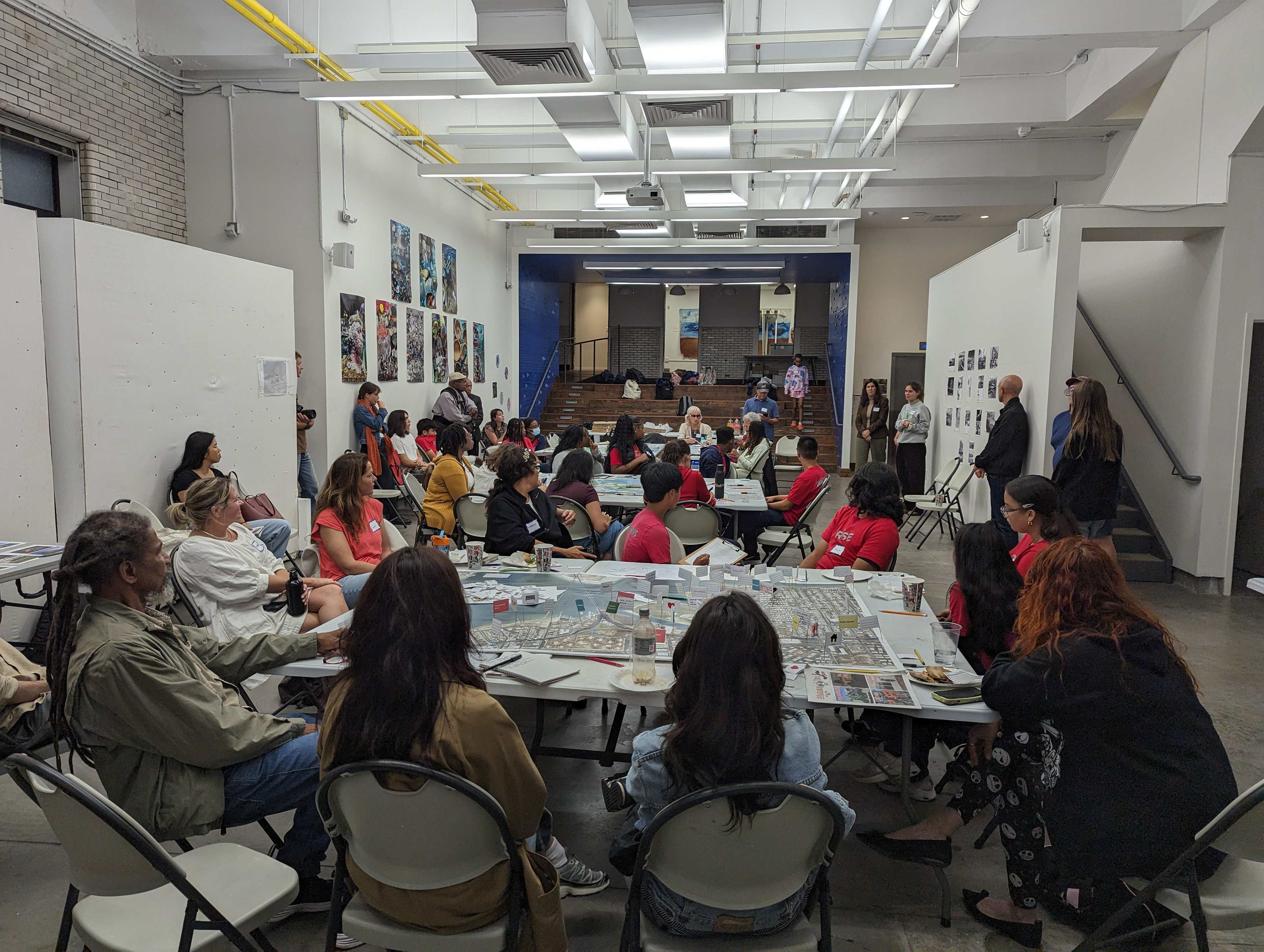
Community workshop at RISE
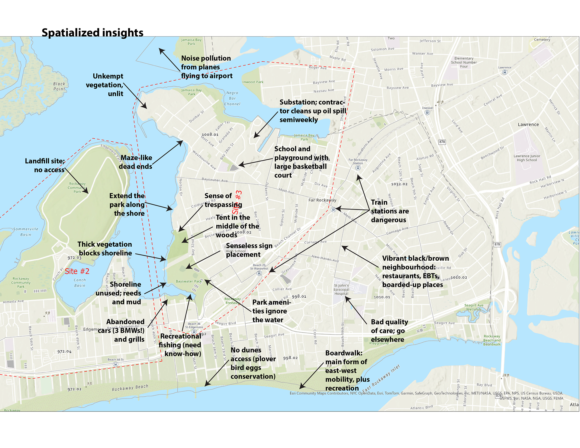
We prepared toolkits consisting of maps and annotation tools. On our first day in the Rockaways, we set up tables at the RISE office and (with the help of RISE youth) engaged local residents in a 90-minute co-design session to help them spatialize their aspirations for their neighbourhoods and the water. Where did they spend their time? How did they get there? What were they worried about? Safety and quality of life were on people's minds; sea level rise and gentrification, not so much.


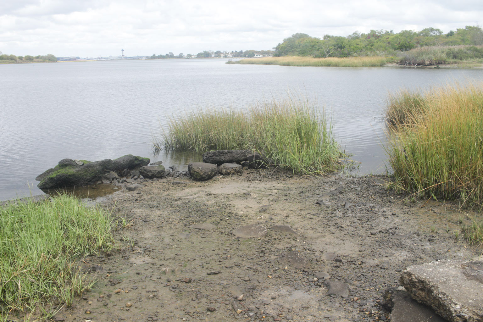
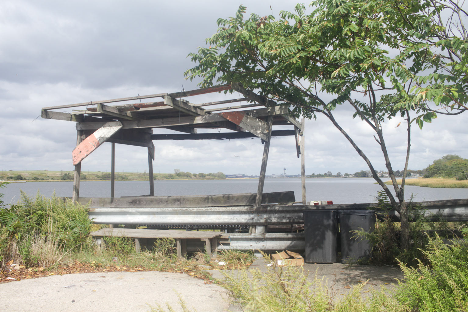
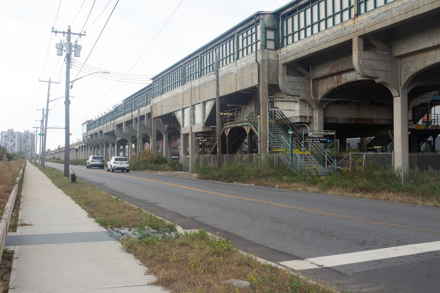
Fieldwork in the Rockaways
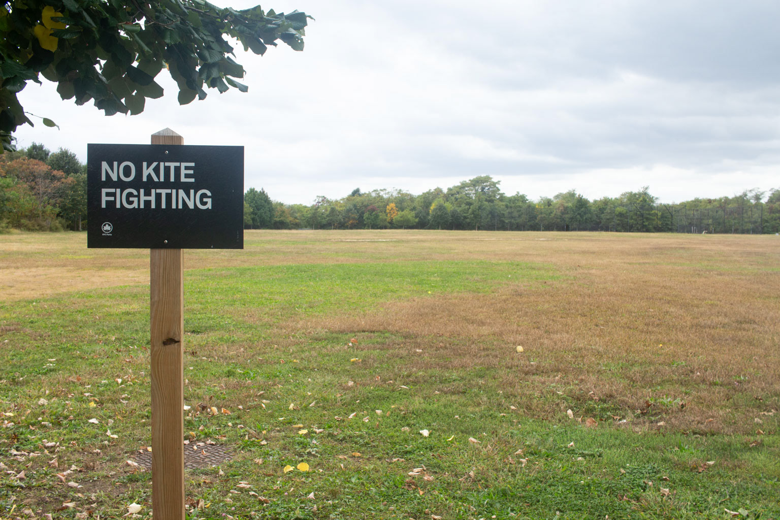
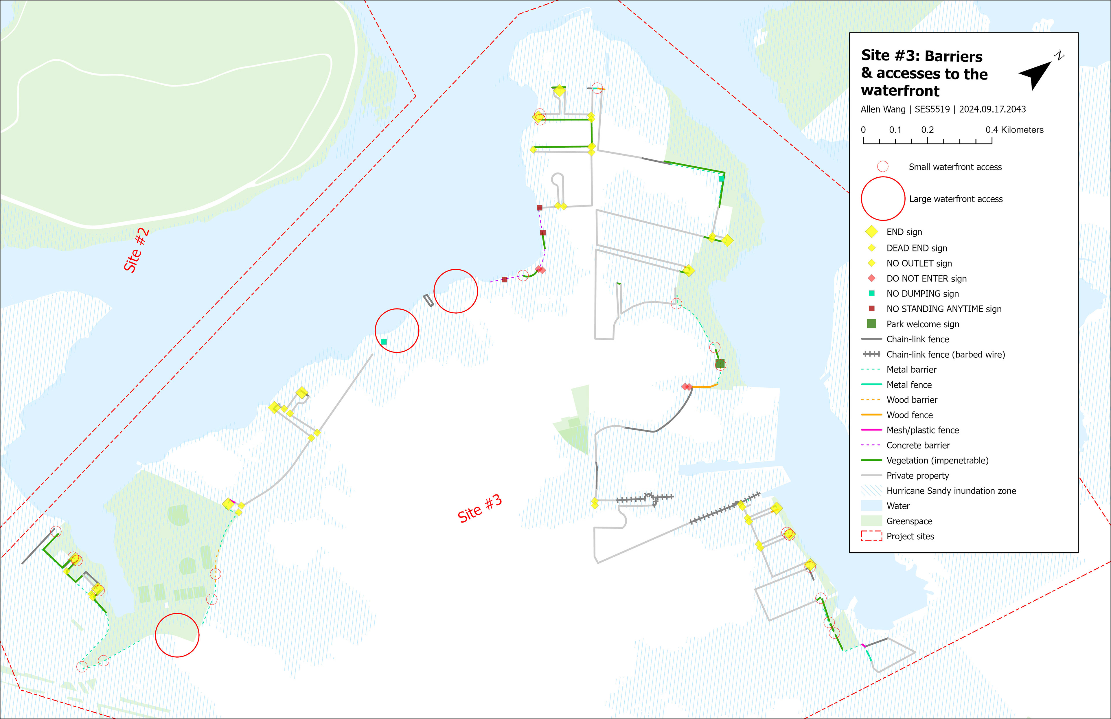
During our one-week site visit in October, we also walked along and across the peninsula. We observed recurring patterns like negative signage ("No __!"), garbage, dead ends, unkempt vegetation, vacant lots, and noisy pollution from the El train, trucks, and airplanes on approach to JFK Airport across the Bay.


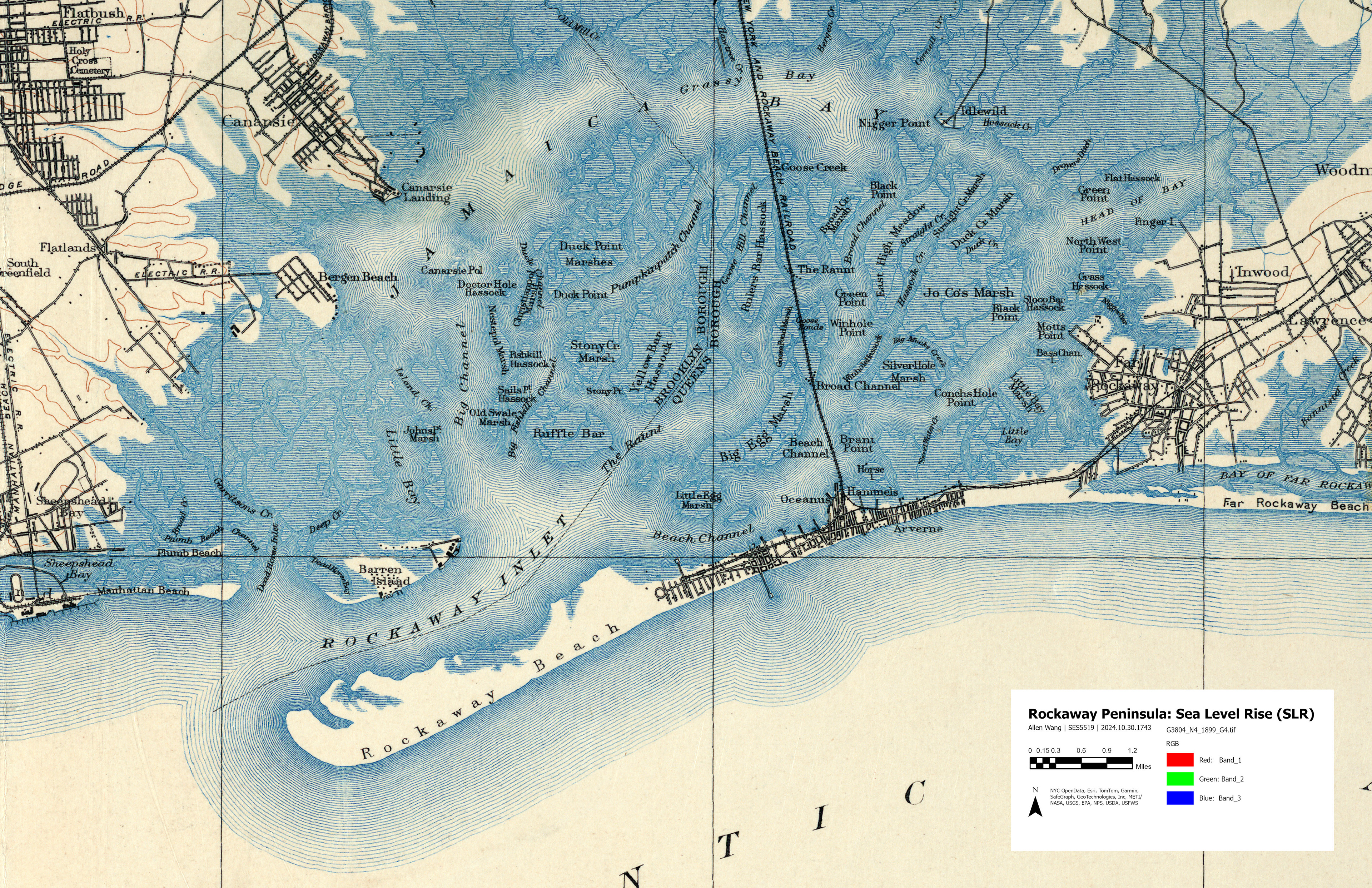
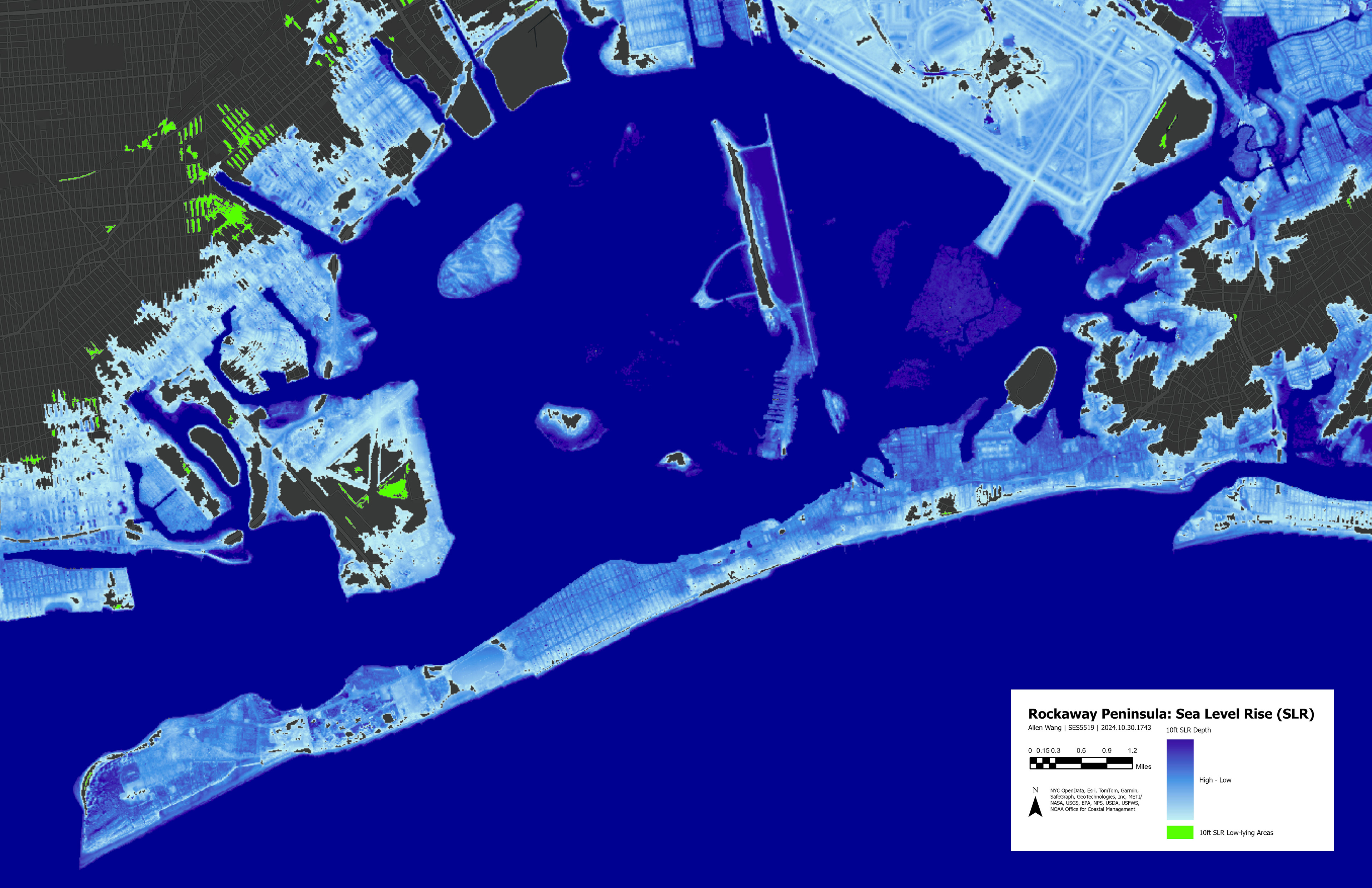
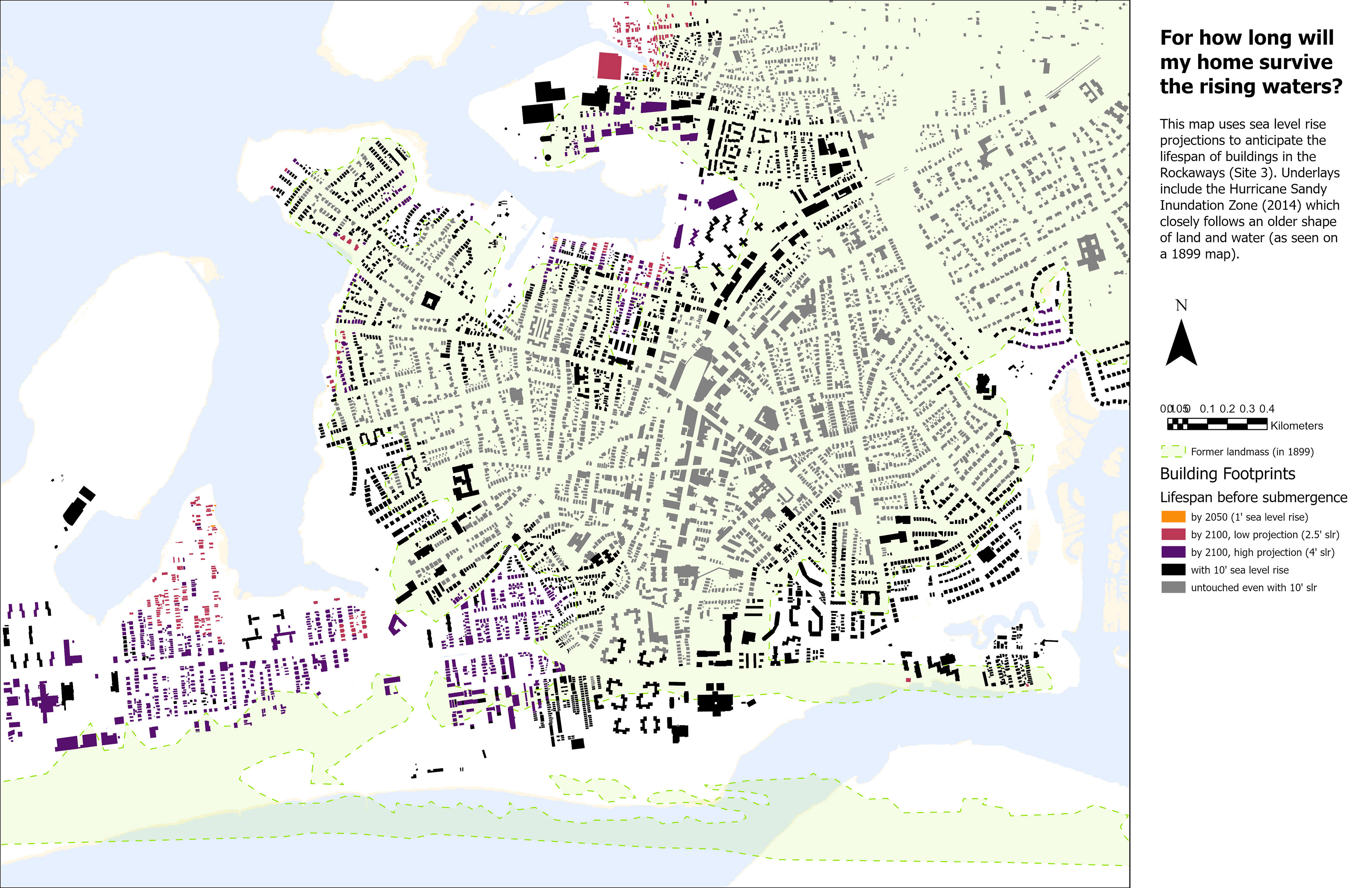
Mapping the site
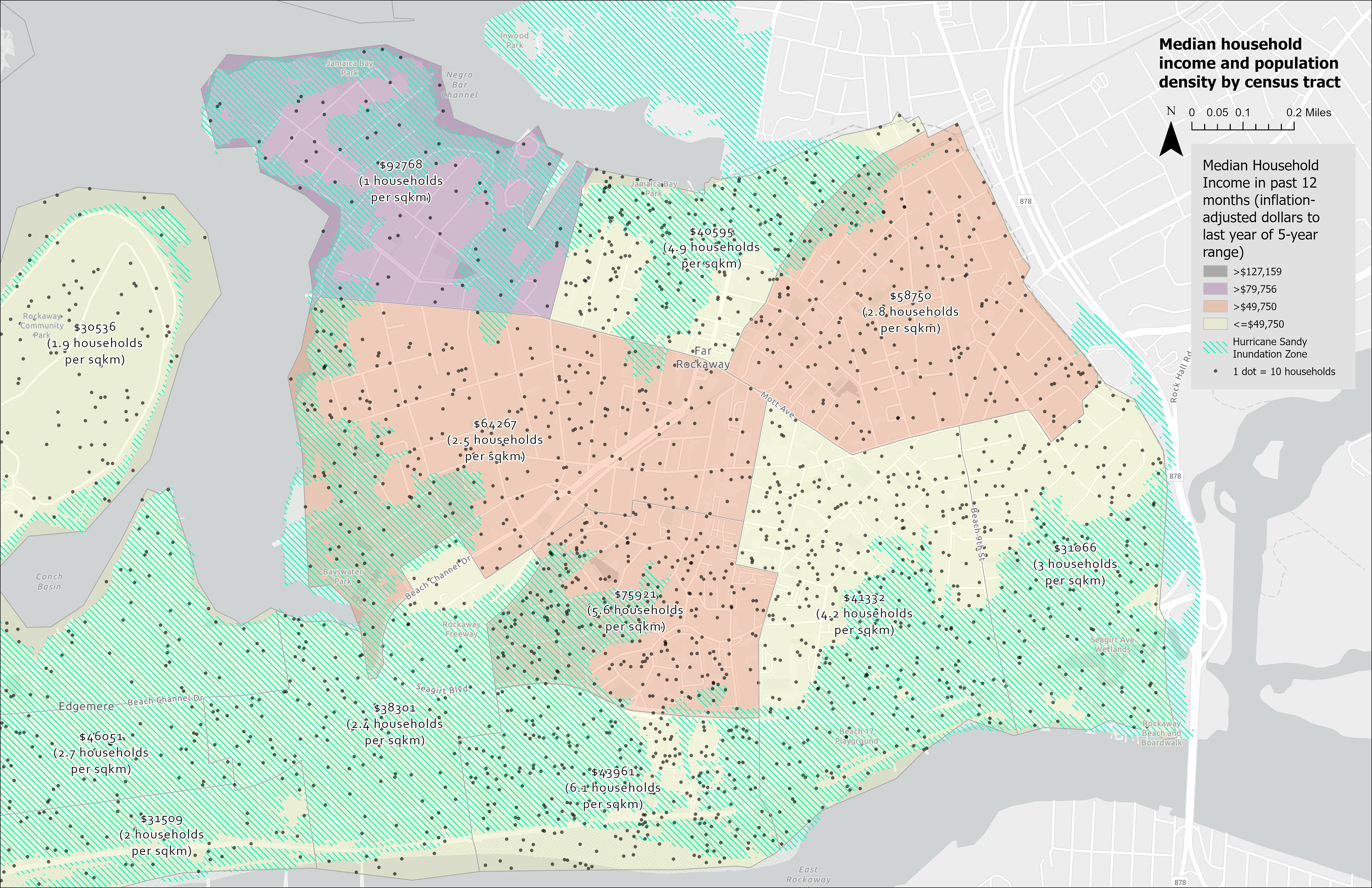
Maps helped us understand ecological and socioeconomic conditions in spatial terms. By overlaying historic maps and sea level rise projections onto buildings and greenspace, we can anticipate how climate change is likely to affect residents in different places. Maps also helped us visualize insights from the workshop and fieldwork.
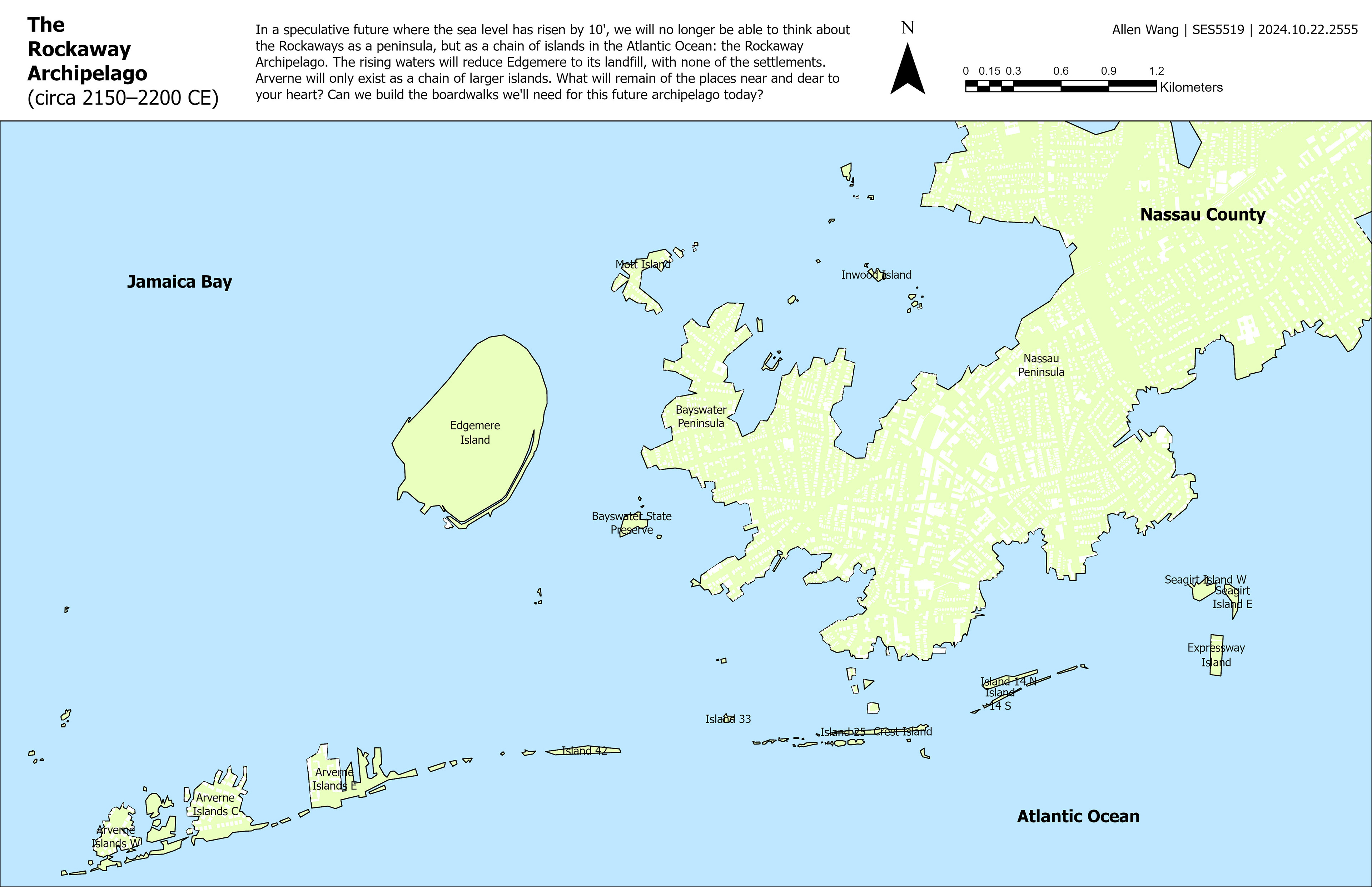
Conceptual development
To produce the final public space plan and spatial strategy, I iterated on renderings and diagrams in Rhino 3D and Adobe Illustrator to improve the clarity and fidelity of my ideas. In particular, an exercise in writing design code (inspired by Michael Sorkin's 1993 book Local Code) blossomed into a speculative constitution for the future Rockaway Archipelago community.


“No man is an island, entire of itself; every man is a piece of the continent, a part of the main. If a clod be washed away by the sea, Europe is the less, as well as if a promontory were, as well as if a manor of thy friend's or of thine own were: any man's death diminishes me, because I am involved in mankind, and therefore never send to know for whom the bell tolls; it tolls for thee.”
—from “Meditation XVII,” John Donne
—from “Meditation XVII,” John Donne